Projects
HOUSING PROJECTS
DAATC Digital Twin Technology Projects
DAATC Digital Twin Technology can do away with the time consuming, laborious and strenuous tasks and can remove the risks of going to hazardous and hard to reach areas.

Pre- Construction Phase
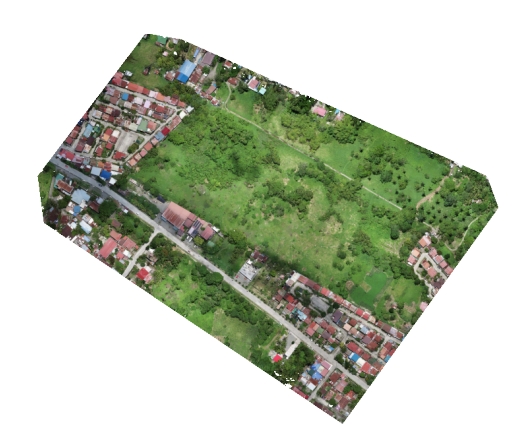
SUBDIVSION PROJECT
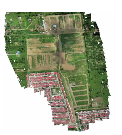
TAGUM PROJECT
DAATC Digital Twin MAPS represents the actual topography and geography including ALL the physical features that are actually on the Site.
Our Client can:
01. Conduct Virtual Inspection, Monitoring and Evaluation of the Project
02. Double check the plan elevation from actual terrain
03. Avoid exporting a lot of extra dirt or a shortage that needs to be purchase and imported
04. See how many trees need to be cut down since cleaning is expensive especially if the stumps need to be removed and taken off the site.
HOUSING PROJECTS
AVANI PROJECT
With DAATC Digital Twin Technology data, it creates a broader sense of conceptualization, thus, estimation of accurate cost and materials can easily be achieved.
Our Client can:
01. Conduct Virtual Surveying by measuring the Distance, Area, Difference in Elevation and Elevation Profile
02. Know the precise number of topsoil stockpile to be exported or used it in a different site after the topsoil has been stripped or scrape
03. Order materials at appropriate time because of limited space in the jobsite
04. Compute accurate volumes of different stockfile material

Construction Phase

Topographic Survey
LANDFILL EARTHWORKS PROJECT
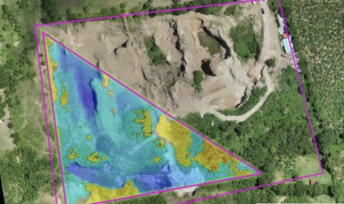
HAGONOY LANDFILL PROJECT
With DAATC Drone Technology it captures considerably more topographic points which results in precise volumetric measurements
Our Client can:
01. Conduct Virtual Surveying by measuring the Distance, Area, Difference in Elevation and Elevation Profile
02. Conduct Virtual Topographic Surveys, including Earthworks Surveys and Stockpiles Calculations
03. Compute Volumes - Cut and Fill
04. Compute Volumetric Computation of material stockfiles
COASTAL ROAD
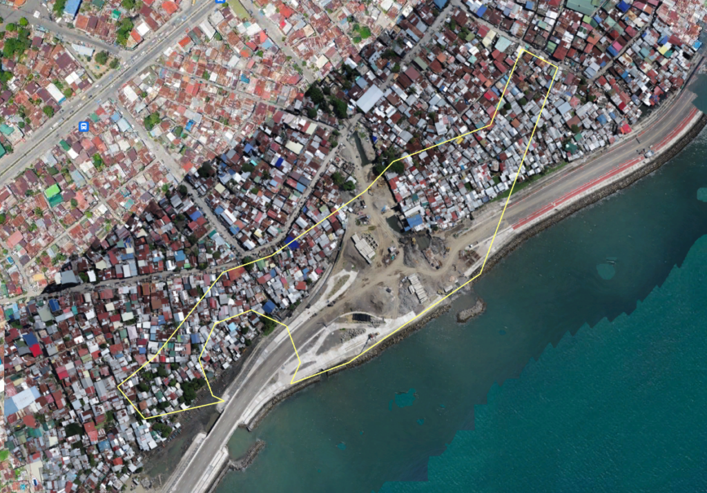
DAVAO COASTAL ROAD
With DAATC Drone Technology is far more much better than the land survey outputs such as survey plans and maps.
Hard to access areas, harsh terrains, steep slopes or dangerous areas can be reached.
Our Client can:
01. Conduct Virtual Inspection, Monitoring and Evaluation of the Project
02. Conduct Virtual Surveying by measuring the Distance, Area, Difference in Elevation and Elevation Profile
03. Visualize, spin, rotate, zoom- in and zoom- out in their Mobile Phones, Tablets, Laptops or Desktops of the Project Site as if they are actually on the ground.

COASTAL ROAD
We Provide the Best Engineering Surveys using Drone Technology
We provide hyper-realistic Digital Twin Technology Maps with accurate data in three dimensional (3D) Models of the site for purposes of inspection, monitoring and evaluation of the projects.
